March 2001: Coyote Buttes Trip (the
Wave)
We left Provo on Friday at 1pm and drove south to Kanab, Utah right
on the Utah/Arizona state line. It rained all night long, but luckily
it quit right before we left. It had snowed just outside of town
and there was snow all around as we drove out 35 miles east on hwy. 89.
The snow dissipated as we descended in elevation. We took a dirt
road south of the highway and had fun crossing a stream in thick mud (with
enough speed even a low-riding Subaru wagon can plow through stuff like
that)! We arrived at the trailhead after 8 miles of dirt road and
a few cows. We signed in at the register and were on our way at 9am.
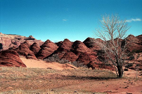
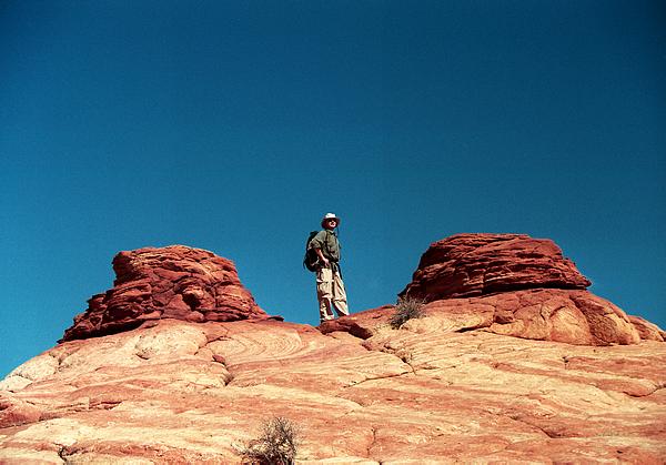
The area we were hiking in (Coyote
Buttes North) is a special district of the Paria/Vermillion Cliffs
Wilderness Area. Only 10 people per day are allowed a permit to enter
the area, and there is a long waiting period (we secured this date almost
a year ago). Because there are no trails or marked routes, we used
Aaron's GPS to lead us in the general direction of the main feature we
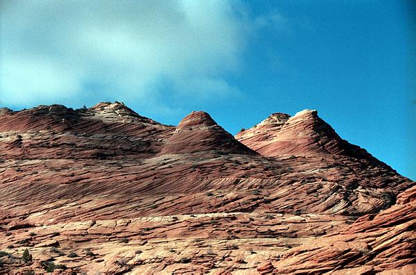
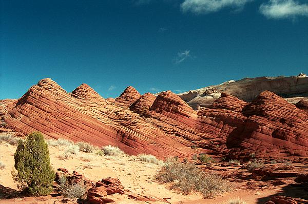
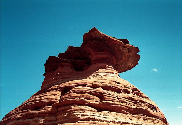
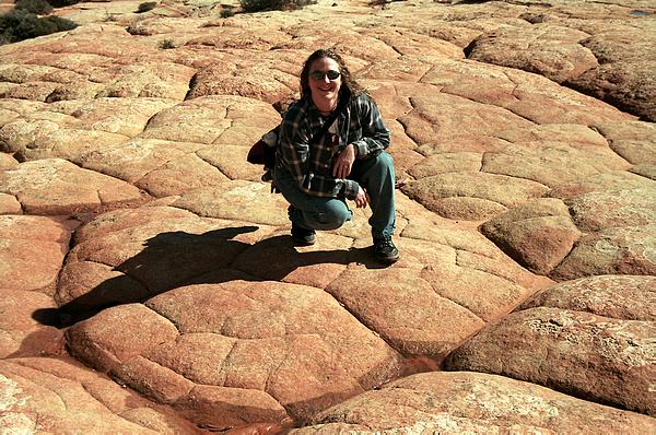
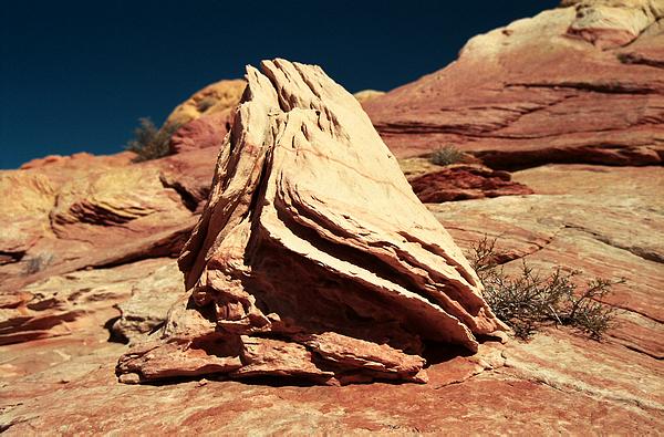
were there to see. Most of the route was over sandstone, but some
was over sand. The rain had helped firm up the sandy portions which
made hiking through them easier, plus it created little pools everywhere.
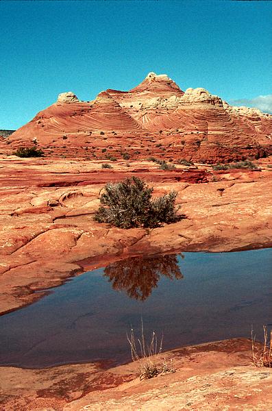
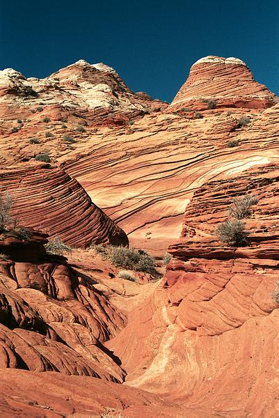
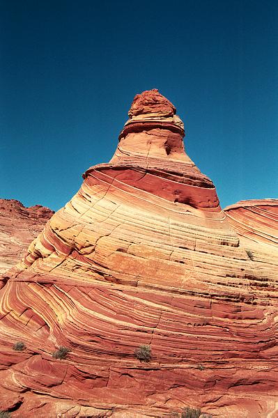
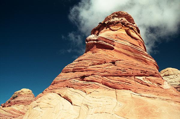
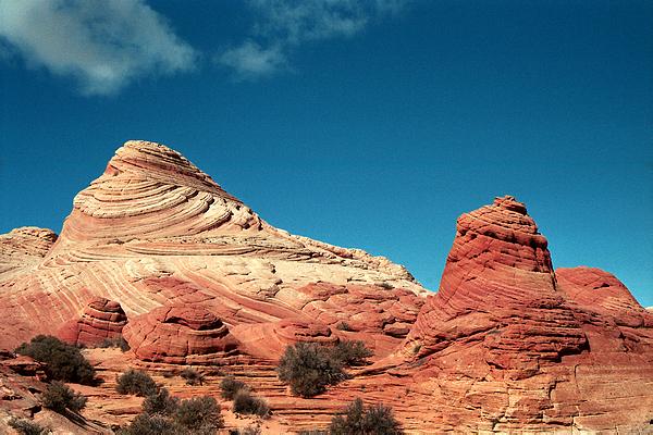
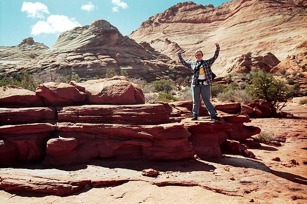
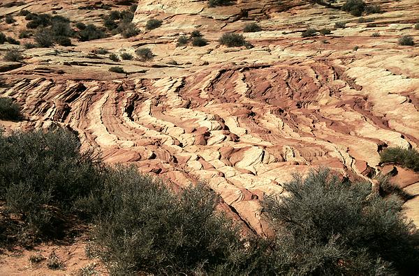
The scenery was spectacular.
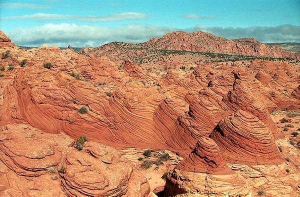
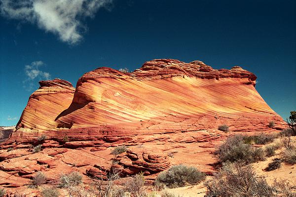
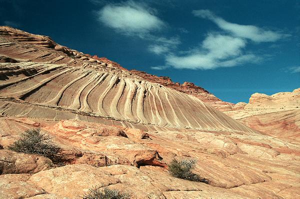
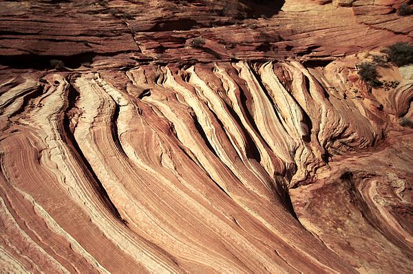
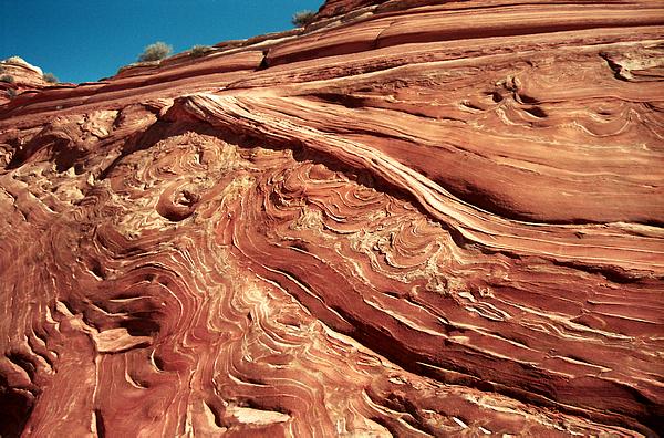
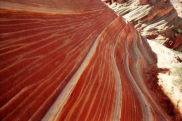
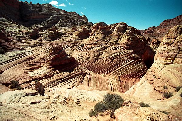
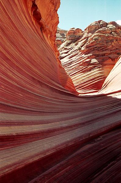
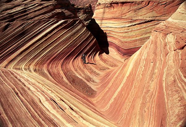
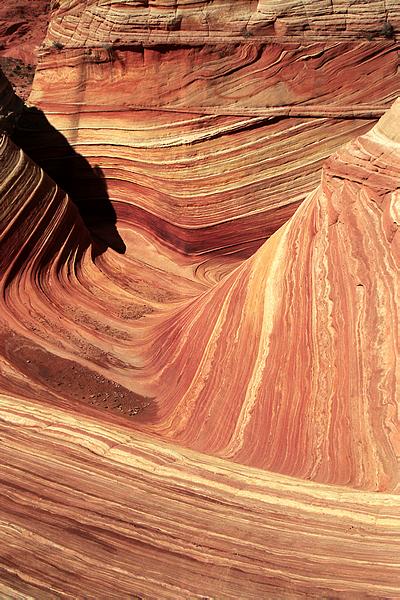
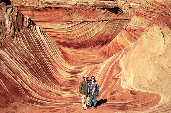
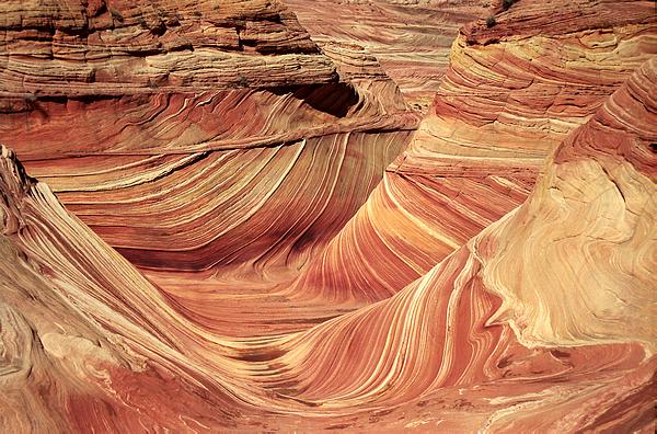
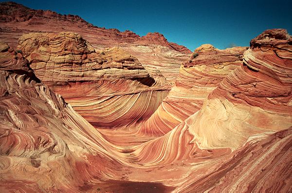
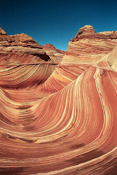
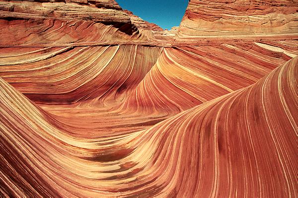
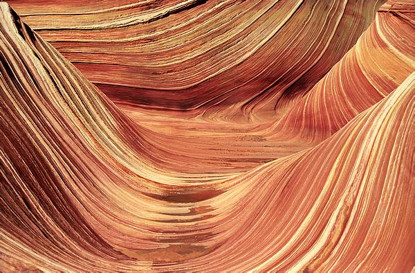
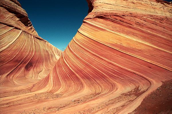
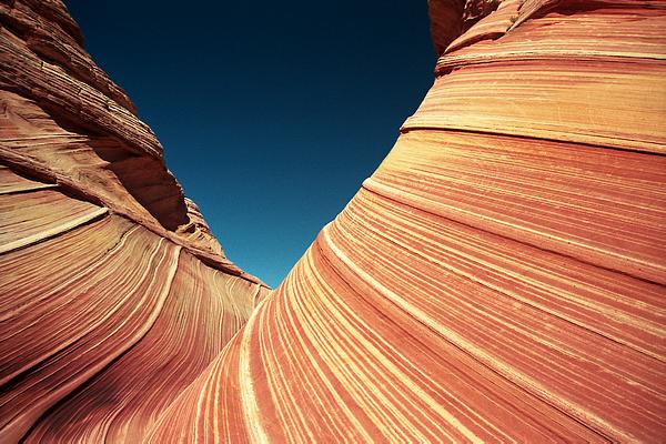
The main destination of our trip was a formation known as The Wave.
It is a beautiful sandstone area eroded mostly by the wind through ancient
sand dunes. It is truly one of the prettiest natural creations we
have ever seen. It is definately the most unique. Aaron took
lots of pictures and Brittney videotaped. We arrived before anyone
else and had it all to ourselves for most of our time there.
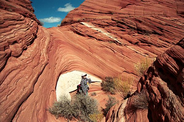
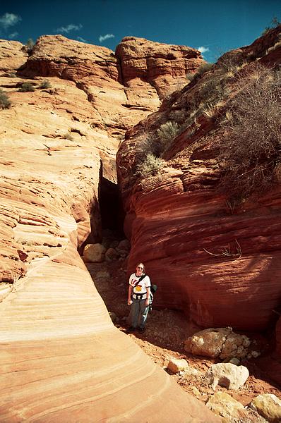
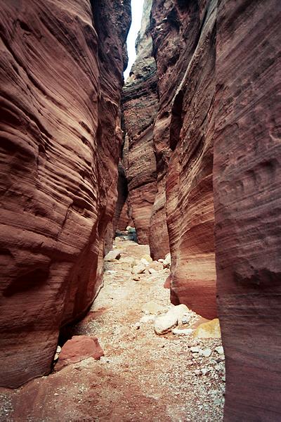
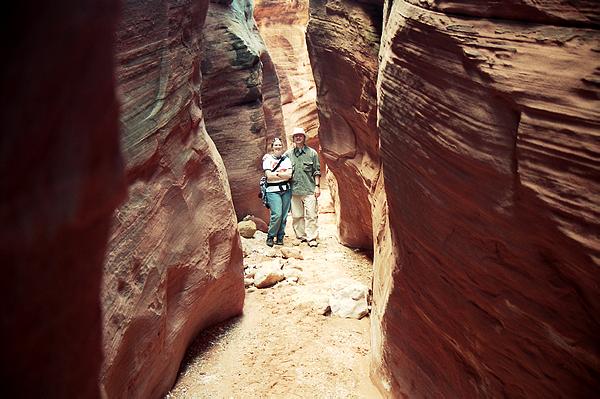
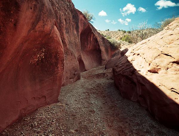
On our way back to the car we took a side trip to Wire Pass. Wire
Pass is a narrow slot canyon leading to the Paria River. That was
pretty cool.
By 2pm and after approx. 10 miles of hiking (according to the GPS) we
returned to the highway and continued east to Page, Arizona. We visited
the Glen Canyon Dam and Lake Powell. The Glen Canyon Dam and Hoover
Dam are almost exactly the same height; quite a bit higher than the Shasta
Dam but much narrower. We took a few pictures of Lake Powell and
Wahweap Bay/Marina before heading back home.
Click HERE to return
to our home page